While often an underestimated component of a positioning and navigation system, a GNSS antenna is critical to a receiver’s success in acquiring all available GNSS signals while rejecting unintentional interference, jamming, multipath and spoofing. GNSS antennas come in as many flavors as receivers, to address the challenges posed by different market sectors, applications, environments and threats to signal integrity.
Each solution reflects a different balance among performance, cost, size and other variables. For example, antennas for handheld devices must be small and lightweight, while those for excavators and dozers can be much larger and heavier but must be able to operate for years while subjected to severe vibrations and harsh environmental conditions. Antennas for military and safety-critical applications must be especially impervious to jamming and spoofing.
Most applications, however, require antennas, like receivers, to have the smallest possible size, weight, power and cost (SWAP-C). Some applications, such as in the automotive market, must also take aesthetics into account.
We asked Javad GNSS, NovAtel, Trimble, Topcon and Harxon about their key markets and the challenges their antennas are designed to address. We also asked them to look back at the past three years and forward at the next three to discuss key innovations. Finally, they discuss technical challenges and industry trends.
See part 1 and part 2 of our GNSS receiver manufacturer overviews.
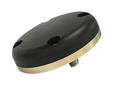
Javad GNSS
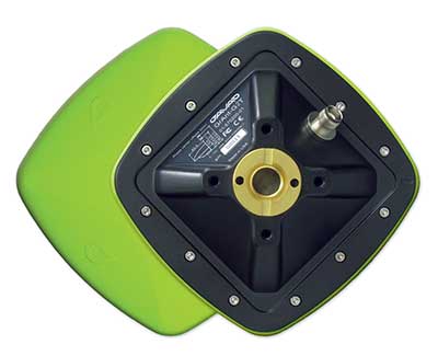
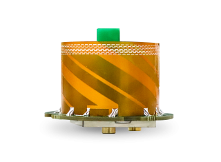
![The GrAnt-G2T antenna. (Photo: Javad GNSS)]()
The GrAnt-G2T antenna. (Photo: Javad GNSS)
Key Markets. “The unmistakable lime-green Javad GNSS receivers and antennas are known to surveyors the world over, and we also support reference station, machine control, precise timing and any other market requiring high-performance / high-precision GNSS antennas,” said Javad Ashjaee, founder and CEO.
Specific Challenges. “A good GNSS receiver should bring in all wideband GNSS signals and reject all other unwanted signals,” Ashjaee said. “J-Shield, a robust filter in our antennas, blocks out-of-band interference — in particular, signals near the GNSS bands, such as the LightSquared signals — making the precious near-band spectrum available for other usages.”
Key Innovations. “To support our users in ever more challenging environments,” Ashjaee said, “such as denied environments where electronic warfare takes place, we have developed a new GrAnt-G2T antenna variant with even stronger J-Shield filtering: improved P1dB (the 1-dB compression point, > –30 dBm) and additional upper and lower out-of-band filtering.”
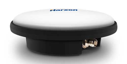
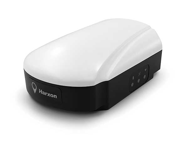
Harxon
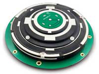
![The HX-CSX100. (Photo: Harxon)]()
The HX-CSX100. (Photo: Harxon)
Key Markets. Harxon is dedicated to designing and manufacturing high-precision GNSS antennas and solutions for industries such as surveying, UAVs and precision agriculture, said Wang Xiaohui, R&D manager.
Specific Challenges. “Harxon’s GNSS antennas primarily address issues related to the reliability of phase center, multi-constellation full-frequency coverage,” Xiaohui said, “tracing unstable satellite signals at low elevations, multipath signal interference, and how to integrate high-precision GNSS antennas and mobile communication antennas into a single design.”
Key Innovations. Over the past three years, Harxon has made “great breakthroughs” in GNSS antenna innovation, Xiaohui said. First, it greatly reduced the size and weight of choke ring antennas. As an example, Xiaohui cited the company’s mini choke ring antenna HX-CGX611A. Second, it optimized accuracy to the millimeter level and expanded to full frequency its quadrifilar helix antenna, such as with the D-Helix antenna. Third, Harxon upgraded the surveying industry to 4G communication by developing a four-in-one antenna that supports multi-constellation with full frequencies and integrates GNSS antennas, Bluetooth and 4G modules with high compatibility and outstanding performance, Xiaohui said, such as with the HX-CSX100. “For the next three years, Harxon will continue its research and investment in antenna technology breakthroughs, especially with regard to further miniaturization and improved performance.”
Technical Challenges. “The first interesting challenge is how to guarantee the performance of the antenna while miniaturizing it per our customers’ demands,” Xiaohui said. The second is reducing the size and weight of antennas with anti-multipath technology, “so as to boost the applications of high-precision positioning GNSS technology.”
Trimble
![An external Trimble antenna helps the GeoXR handheld achieve survey-grade accuracy. (Photo: Trimble)]()
An external Trimble antenna helps the GeoXR handheld achieve survey-grade accuracy. (Photo: Trimble)
Key Markets. “Trimble’s core technologies in positioning, modeling, connectivity and data analytics enable customers to improve productivity, quality, safety and sustainability,” said Stuart Riley, vice president, GNSS Technology. “From purpose-built products to enterprise lifecycle solutions, Trimble software, hardware and services are transforming industries such as agriculture, construction, geospatial, transportation and logistics, rail, forestry, utilities and autonomous applications.”
Specific Challenges. Each application has different requirements, Riley said. “For applications that require the highest position accuracy, the stability of the phase center, multipath mitigation, and the unit-to-unit production consistency are critical,” he said. Some customers require high performance in challenging environments — such as the high vibration experienced on construction equipment — while others require smaller, lower-cost antennas and can tolerate a slight reduction in accuracy. “The antenna is typically a combination of a passive antenna element with an active low noise amplifier (LNA),” he said. “The LNA needs to be carefully designed to remain linear in the presence of in-band jamming while rejecting out-of-band signals. There are size and cost trade-off challenges to the filter roll-off at the band edge that need to be managed.”
Key Innovations. For high-precision applications, Trimble first released the Zephyr series of antennas in the late 1990s. “It provides excellent phase center stability and unit-to-unit production repeatability, and has exceptional multipath mitigation performance, which is enhanced in the geodetic version,” Riley said. Since first introducing the antenna, Trimble has added support for additional GNSS systems and RF bands (L1/E1, L2, L5/E5 and L6/E6), transitioned to a RoHS-compliant manufacturing process, improved the LNA performance, developed rugged versions for construction vehicle mounting, and produced a smaller version used in the Trimble R10, R12 and SPS986 GNSS receivers.
“More recently,” Riley said, “we developed a lower-cost high-performance antenna for the Trimble Catalyst software-defined GNSS receiver for Android phones and tablets, as well as an antenna in the Nav-900 guidance controller for agriculture that implements a metamaterial design. Looking forward, we expect to continue to innovate by providing antennas that meet the needs of the different markets we serve. Each application has unique requirements, which require us to balance the cost, performance and size to develop the appropriately optimized product. Enhancements will include novel antenna architectures, production technique improvements, and careful material selection.”
Technical Challenges. Trimble users have a wide variety of requirements, Riley said. “The challenges come in balancing the seemingly conflicting needs for performance, size, weight and cost. Because Trimble focuses on specific user segments, we can provide antenna solutions that are the best fit for the various applications. For example, an antenna in a handheld device must be small and lightweight; however, on a construction machine, durability takes precedence over size and weight.”
Topcon Positioning Group
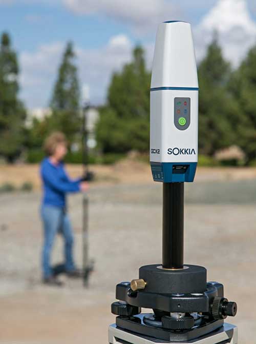
![The Sokkia GCX2 receiver integrates a helical antenna. (Photo: Topcon)]()
The Sokkia GCX2 receiver integrates a helical antenna. (Photo: Topcon)
Key Markets. Topcon Positioning Group is a leading designer, manufacturer and distributor of precision measurement and workflow solutions for the global construction, geospatial and agricultural markets, according to Alok Srivastava, director, product management. “By integrating high-precision measurement technology, software, services and data, Topcon has a vision to improve productivity to meet global demand for sustainable infrastructure and agriculture,” Srivastava said.
Specific Challenges. The physical challenges when designing an antenna for geomatics applications have been multipath and interference mitigation, Srivastava explained. “Topcon has an advanced research and development team that focuses solely on antenna designs. The team dedicates its efforts to providing state-of-the-art antennas for all positioning needs.”
Key Innovations. “Topcon was very early in realizing the growing needs for radio spectrum and the challenges it may bring to GNSS technology,” Srivastava said. “It has innovated and used filters to mitigate interference from Japan LTE signals for a long time.”
Topcon’s antenna team is “among the most innovative in the industry,” Srivastava said, and “has brought many unique designs of antennas over the years. The antenna is a key element of an integrated receiver in dictating the design of the whole receiver.” With the release of the Sokkia GCX2 receiver, he explained, his company introduced to the industry the integration of a helical antenna into a high-performing integrated receiver.
Its infrastructure antennas, the CR-G5 and PN-A5, are available with options including cavity filter technology. “The cavity filter has the superior ability to minimize near-band interference,” Srivastava said. Topcon’s antenna farm at the Concordia test site in Italy contains an absolute calibration robot, a large format antenna (BigAnt) for a high-quality geodetic ground station, and patented technology for controlled testing of GNSS technology in artificial obstructions.
“Vibration mitigation is the key when an antenna is mounted to a piece of machinery,” Srivastava said. “Topcon antennas are an integral component of our Quartz Lock Loop (QLL) technology for robust GNSS operation in high-vibration environments.”
Technical Challenges. The importance of antennas can be underestimated, Srivastava pointed out, especially with rapidly growing interest in GNSS technology in consumer applications. “The antenna is one of the most critical technologies when it comes to reliable and robust GNSS positioning. Designers and manufacturers of antenna technology with years of experience understand the seriousness of this task, and are fully equipped to deliver results without compromising quality and performance.”
NovAtel
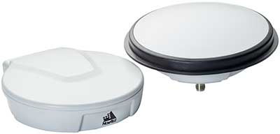
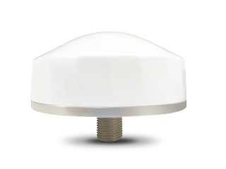
![The VEXXIS family of GNSS antennas. (Photo: NovAtel)]()
The VEXXIS family of GNSS antennas. (Photo: NovAtel)
Key Markets. Key antenna markets for Hexagon’s Autonomy & Positioning division are split into three areas, according to Dean Foster, director of hardware engineering. His area includes the company’s anti-jamming antenna technology (GAJT) and robust SWAP-C antennas. The other two are precision and SMART antennas for agriculture, mining, survey and autonomous vehicles (Vexxis, SMART7, and GNSS 1500), and reference GNSS antennas (GNSS750 and ANT-C2GA).
Specific Challenges. NovAtel’s antennas address three main challenges. First, jamming and interference, whether intentional or unintentional, are becoming increasingly commonplace and seriously impact GNSS reception. “These issues are addressed by our GAJT product line of high-precision anti-jamming antennas, which can mitigate multiple jammers simultaneously,” Foster said. Second, “the stability and precision of the antenna’s phase center is critical to deliver robust and precise GNSS position even in challenging environments, which is addressed by our Vexxis GNSS-800 antennas.” Finally, more frequent use of GNSS in environments with reflection issues is making multipath rejection critical. “The entire line of NovAtel antennas, including Vexxis, SMART and GAJT, ensures use of the most direct signals.”
Key Innovations. Driverless vehicles require sub-meter-level positioning for lane-level resolution. “Multi-constellation/multi-frequency GNSS with protection limits and correction services are necessary to move forward safely,” Foster said. “This technology does not work with the smallest size, single-frequency, narrow-band antennas that cars currently utilize, so we’re building on our deep experience and knowledge to develop production-grade automotive antenna technologies.” An emerging requirement is reducing size, weight, power and cost (SWAP-C). “In the defense market, we first offered jamming and interference mitigation with the GAJT-710, which progressed to the GAJT-AE, and most recently we launched the GAJT-410.”
Technical Challenges. All markets want the smallest, most robust and cost-effective antenna to meet their needs, Foster said, adding that NovAtel is helping customers work through how to select, place and integrate antennas into their platforms to address real-world problems.
Cobham Aerospace Connectivity
![The 20-2041 Fixed Reception Pattern Array (FRPA) GPS antenna. (Photo: Cobham Aerospace)]()
The 20-2041 Fixed Reception Pattern Array (FRPA) GPS antenna. (Photo: Cobham Aerospace)
The prevalence of intentional and unintentional GNSS interference has sparked quick evolution in antenna technology, including the emergence of breakthrough technology in 2019 and new advancements in development, said Imtiaz Bahadur, product line manager.
Specifically, the drive to advance antenna technology is due to “an increased demand for broader coverage, stringent industry compliance, and a need for robust capabilities.”
Key Innovations. Among recent innovations in antenna technology, Bahadur cited GPS antennas with support for dual-frequency multi-constellation compliance with Global Aircraft Traffic Management (GATM) mandates to enable military aircraft to operate in controlled airspace, and antennas that offer broader band coverage.
In 2019, Cobham introduced the 20-2041 Fixed Reception Pattern Array (FRPA) GPS antenna, which addresses all three of these priorities, said Darren Windust, product manager – air. The L1/L2 dual-frequency GPS antenna is certified to both ETSO-C190 and MSO-C144. “In conjunction with a certified receiver, the 20-2041 offers a single solution to comply with GATM regulations to access controlled airspace and undertake GPS precision approach and landings, in a standard 3.5-inch form factor.”
Technical Challenges. “It’s clear that moving from one GPS signal to eight signals from four constellations in support of performance-based navigation is going to be the next major disruptor because of the significantly expanded signal power and highly efficient design,” Bahadur said. The quest to make antennas smaller also continues. “Today, there are physical limitations on how far one can miniaturize the antenna while ensuring sufficient gain is received. Research and development efforts are underway to build ‘smart antenna’ concepts for the future. Moving into the next few years, robust antenna capabilities will arrive in smaller, more efficient form factors.”